 © STRAVA GLOBAL HEATMAP
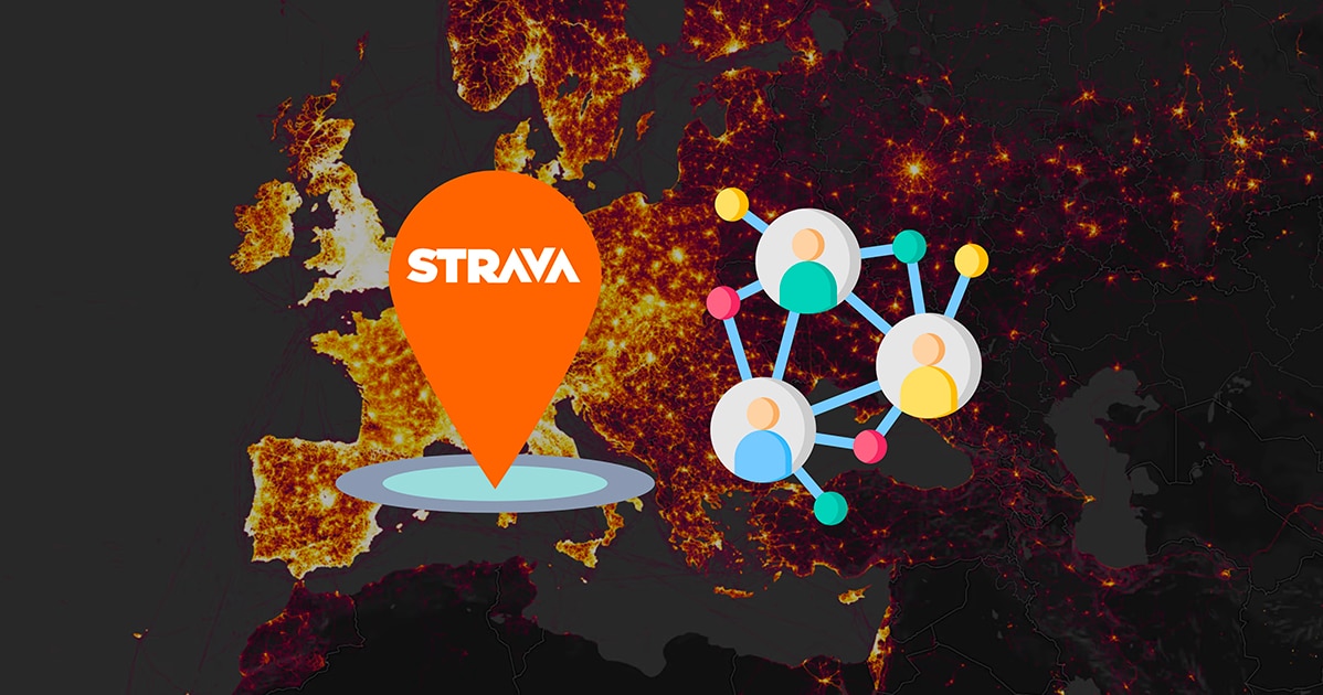
When Strava Puts National Security to the Test
This is the story of a sports app that simply wanted us to run faster… but ended up disclosing military secrets. When Strava released its famous heatmap, it surely didn’t expect to reveal the location of secret bases in the middle of the desert. An absurd yet revealing story about the dangers of excessive geolocation. Could your Sunday jog be saying more than you think?
Initially, everyone thought it was fantastic. Strava was the social network for happy athletes, turning your outing into a performance and your route into a virtual medal. An app that cheers you on, encourages you, and gently compares you to others on iconic “segments.” A hill, an incline, a stretch of pier: everything could become a playground. However, in this vast digital hide-and-seek, some played the game… unaware they were revealing more than just a personal best. Strava became a habit for millions: running, cycling, trail running, hiking… and even a few military personnel on missions.
| From Segment Thrills to Strategic Jitters
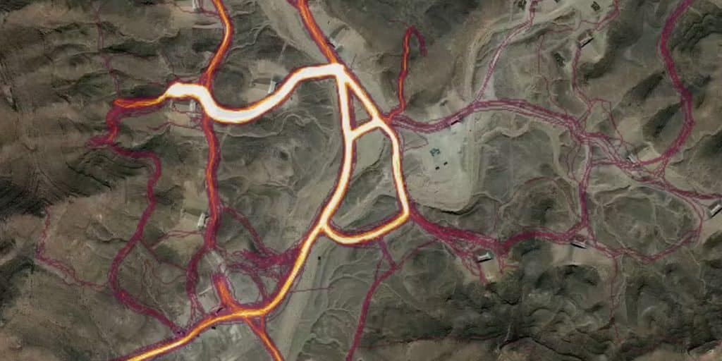
In 2018, the app proudly launched a “heatmap” worldwide. A visual gem, showing where people move all around the globe. On paper, a brilliant idea: we see the Buttes-Chaumont park packed with runners, the roads around Mont Ventoux ablaze with cyclists. But this map revealed a bit too much. Notably, isolated zones in Syria, Libya, and Africa, where perfect circles appeared in the desert. Not exactly tourist hotspots… unless you look a bit closer.

Sure, most of the military sites on this interactive map were already known. This includes US deployment bases in Iraq, Afghanistan, and even Syria. For example, it also included the French base of Madama, in the far north of Niger, whose location the French command never hid. But routes recorded by the app can reveal much more than just a morning jog. They map habits, sensitive routes, like the most frequented paths by patrols or logistical convoys. Not exactly the kind of info a military command dreams of seeing disclosed. Unsurprisingly, the Pentagon informed the Washington Post that it was assessing the risks related to publishing this data.
| “Hello, this is Secret Base No. 42”
The circles aren’t random. They depict repeated routes of Strava users, looping around a specific perimeter. U.S., French, or British military personnel, running around their operational camp. And since this is recorded by GPS and automatically published (by default!), these individual movements gradually form an invisible map… which becomes visible to anyone.
Where Google Maps remains vague, Strava lights up. We’re talking classified military camps, strategic positions that no official source confirms. Yet, here it is, before our eyes: a bright fluorescent pink trail. The open source intelligence (OSINT) found a new tool to scrutinize, and this blunder caused quite a stir in military headquarters.
| When Digital Ego Surpasses Military Discretion
The fascinating thing is, this flaw isn’t a bug. It’s not a cyber attack. It’s just… the modern world putting too much trust in tech. Because we share everything, all the time. Because we’re proud of our runs, even in uniform. Because we forget that “public by default” is rarely a good idea when wearing a bulletproof vest.
Strava isn’t solely to blame: the entire model of connected apps is under scrutiny. When we click “OK” without reading the terms, when we post our routes without questioning, when we turn our performances into visible content, we’re feeding a machine much bigger than us. And sometimes, we unknowingly give ultra-sensitive information to the world.
| The lesson? Turn off Geo and Open Your Eyes
Since then, protocols have been reviewed, particularly in the military. Strava has strengthened its privacy options, and military personnel have been reminded about using their smartwatches. But the alarm bell has rung far beyond the bases. This story is a mirror held up to our digital lives. Our daily routes, habits, coffee breaks, hours of outings… everything is geolocated, archived, sometimes shared without wanting to.
As Rafael Nadal once said about his habit of analyzing every detail of his opponent: “ Each little move gives you hints.” In this ultra-connected world, our little moves give much more than hints. They draw our map. And that of others.
| Strava, or the Art of Outrunning Your Shadow
This case study proves one thing: when tech outpaces caution, it sometimes ends up shooting itself in the foot. We just wanted to beat our record over 5 km, and we ended up exposing a command post’s location. It’s not a dystopia; it’s a news story. And tomorrow, it could be you, me, or any casual runner unknowingly sharing too much.
Next time an app asks you to enable geolocation “for a better user experience,” remember what Strava revealed to the world: that even in shorts and sneakers, we can become an international security issue.
 04/12/2025
 04/12/2025
 25/11/2025